


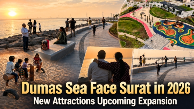
Dumas Sea Face Surat 2026: The Transformation of an Eco-Tourism Hub
The landscape of South Gujarat’s coastline has officially shifted. Long known for its mystical urban legends and unique black sand, Dumas Beach has undergone a massive structural change. Spearheaded by the Surat Municipal Corporation (SMC) and the Surat Urban Development Authority (SUDA), the Dumas Sea Face Masterplan has successfully activated Zone 1 of its multi-phase redevelopment blueprint, turning the waterfront into a flagship public space.
The Master Plan: Balancing Urbanism and Ecology
The entire project spans an ambitious 252.20 acres, systematically resolved into four distinct development zones. Phase 1 focuses heavily on a 31.8-acre urban hub custom-designed for recreational, cultural, and eco-tourism activities.
Rather than standard concrete barriers, the edge of the promenade uses fluid, marine-inspired geometries. The infrastructure seamlessly accommodates natural movement, public gathering, and the environmental flux of the Arabian Sea.
Key Upcoming Attractions and Spatial Highlights
- The 1-Kilometer Sea-Facing Walkway: A broad, pedestrian-first promenade that integrates barriers, seating, and sand-toned, weather-resistant natural stone designed to withstand highly saline conditions.
- Marine-Themed Architectural Accents: Sculptural installations, street furniture, and shading structures take design cues from organic shapes like waves and seashells.
- Nocturnal Landscape & Layered Lighting: To extend the beach’s usability into the night safely, a sophisticated lighting strategy highlights walkways, nodes, and plazas.
- Organized Food & Multi-Cuisine Plazas: Streamlined retail spaces host over 400 street food varieties, bringing Surat’s famous culinary culture (from locho to bhajiya) into an organized public market.
Redevelopment Blueprint:
• Total Area: 252.20 Acres (4 Zones)
• Zone 1 Focus: 31.8 Acres Urban Eco-Tourism Hub
• Primary Axis: Integration with the historic Dariya Ganesh Temple
Coastal Resilience: Engineering for Climate Challenges
Beyond recreation, the Dumas Sea Face project is a model for modern climate-adaptive architecture. Coastal engineering protocols drive the entire landscape design to protect against rising sea levels and intense seasonal monsoons.
Nature-Based Wave Dissipation
Instead of high concrete seawalls that cause beach erosion, the project implements a layered system of natural stone barriers and porous edges. These features break up incoming wave energy and minimize sand displacement during high tides.
Flood Mitigation Systems
The public plazas are built using highly permeable surfaces and integrated bioswales. These green drainage systems capture stormwater, filter pollutants naturally, reduce runoff, and recharge local groundwater tables. The entire zone is graded to handle periodic tidal flooding without taking damage or disrupting structural safety.
Must read, Dumas Beach 2026 Travel Guide
Upcoming Expansion: What lies ahead for Dumas?
With Zone 1 now accessible to the public, SMC is moving forward with engineering assessments for the remaining three zones of the 252.20-acre layout. Future expansion plans involve dedicated water sports arenas, an eco-awareness park, and a conservation zone to protect the area’s native flora and fauna. These additions ensure Dumas Sea Face remains a key destination for sustainable tourism in Western India.
Coastal Resilience: Built to Last
A critical aspect of the Dumas expansion is environmental sustainability. The design utilizes porous edges, permeable surfaces, and native salt-tolerant coastal planting to dissipate wave energy, mitigate local flooding, and handle seasonal tidal fluctuations without interrupting public access.
Also read, Is Dumas Sea Face Going Paid? Surtis Raise Concerns
Watch Latest News Videos on KRH News: Click Here