

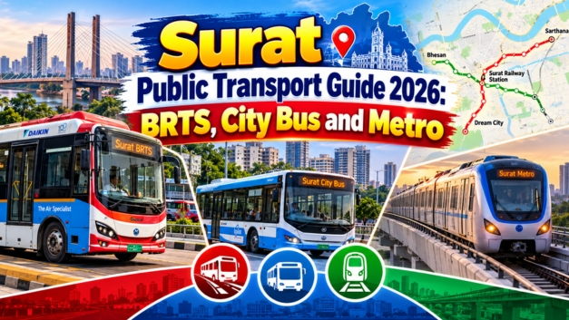
Surat Public Transport Guide 2026: Surat is one of Gujarat’s fastest-growing urban centres, known for its diamond industry, textile markets, expanding residential areas and busy commercial districts. As the city grows, public transport has become increasingly important for daily commuters, students, workers and visitors.
In 2026, Surat’s public transport network is built around two established bus services: the Bus Rapid Transit System (BRTS) and Sitilink city buses. At the same time, the Surat Metro project is moving through construction and trial stages, with the potential to change how people travel across the city in the coming years.
From the launch of BRTS in 2014 to the planned metro corridors connecting Sarthana, Dream City, Bhesan and Saroli, here is a complete guide to Surat’s public transport history, current situation and future planning.
Surat Public Transport Guide 2026: Quick Overview
| Transport system | Status in 2026 | Main purpose |
|---|---|---|
| BRTS | Operational | Bus services on designated BRT corridors |
| Sitilink city buses | Operational | City and suburban connectivity |
| Surat Metro | Under construction, with trial activity reported | High-capacity urban rail connectivity |
| Sitilink mobile app | Available | Route planning, bus information and ticket-related services |
| Future integrated transport | Planned and developing | Better connections between buses, metro and major transport hubs |
Surat Municipal Corporation’s Sitilink information page lists BRTS operations across 12 routes and city bus operations across 44 routes. It reports 166 BRTS buses and 575 city buses, with average daily ridership figures of approximately 1.4 lakh and 1.35 lakh respectively. These figures are from the corporation’s published service information and should be treated as reported network statistics, rather than a live count for every day of 2026. Source: Surat Sitilink
1. History of Public Transport in Surat
Before BRTS: A city growing beyond its traditional transport network
As Surat expanded beyond its older urban core, residential neighbourhoods, industrial estates and commercial areas became increasingly spread out. People needed practical ways to travel between railway stations, markets, workplaces, educational institutions and developing suburbs.
Conventional buses, auto-rickshaws, two-wheelers and private vehicles all played a role in urban mobility. However, a growing city also needed a more organised public transport network that could connect important areas with greater consistency.
The development of BRTS and city bus services became part of Surat’s broader effort to create a more integrated transport system.
2014: Surat BRTS begins operations
An important milestone came in January 2014, when Surat inaugurated its first BRTS corridor, measuring approximately 10.3 kilometres, according to Surat Sitilink.
BRTS was designed to provide a more organised bus service using dedicated or designated corridors and purpose-built stations along selected routes.
The initial network subsequently expanded. Surat Municipal Corporation’s published BRTS information describes a network of approximately 102 kilometres in operation, connecting different parts of the city and surrounding urban areas.
The expansion helped establish bus-based rapid transit as a key component of Surat’s public transport system. Source: Surat Sitilink – About Us
Expansion of the city bus network
Alongside BRTS, Surat’s city bus services developed to serve neighbourhoods that were not directly connected by rapid transit corridors.
The city bus network serves an important function: it can connect residential areas to BRTS stations, commercial districts, industrial zones and other destinations.
The two systems are intended to complement each other. BRTS offers connections along designated corridors, while city buses provide additional coverage across urban and suburban areas.
The metro era: A new phase in urban mobility
Surat Metro represents the next major stage in the city’s transport development. The Phase 1 project was approved by the Government of India in March 2019, with a reported project cost of approximately ₹12,020 crore. Gujarat Metro Rail Corporation (GMRC) is responsible for implementation.
The approved Phase 1 network consists of two corridors spanning 40.35 kilometres, with 38 planned stations. Construction began in January 2021. Sources: SMC and GMRC.
2. BRTS in Surat: Routes, Benefits and How to Travel
BRTS stands for Bus Rapid Transit System. Unlike a conventional city bus service, BRTS operates along designated corridors with dedicated stations and infrastructure intended to improve passenger movement. For commuters travelling along a BRTS corridor, the service can provide a practical alternative to private vehicles.
Major BRTS route connections
Surat Sitilink’s published timetable lists several route connections, including:
| Service | Published origin | Published destination |
|---|---|---|
| BRT 11 | Udhna Darwaja | Sachin G.I.D.C. |
| BRT 12 | ONGC Colony | Sarthana Nature Park BRT |
| BRT 13 | Jahangirpura Community Hall | Kadodara |
| BRT 16 | Kosad Depot | Sachin GIDC Junction |
| BRT 18 | Railway Station Terminal | Utran R.O.B. Bridge |
| BRT 19 | Railway Station Terminal | Kadodara |
| BRT 22 | Kosad EWS H2 | Sarthana Nature Park BRT |
These are examples from the published timetable, not a complete route list. Route numbers, stops and operating arrangements can change, so commuters should verify the latest information before leaving.
Official timetable: Surat Sitilink – Time Table
What are the advantages of BRTS?
- Designated corridors: Helps organise bus movement along selected routes.
- Station-based boarding: Makes it easier to identify boarding and alighting points.
- Affordable public transport: Provides an alternative to travelling by private vehicle for suitable journeys.
- Connections to key areas: Published routes serve locations including Sarthana, Kosad, Udhna, Sachin GIDC and the railway station area.
- Potential connections with other transport: BRTS can form part of a wider journey when combined with city buses and other modes.
Actual travel time depends on the route, traffic conditions, service frequency and distance to the station.
3. Sitilink City Buses: Connecting Surat’s Neighbourhoods
While BRTS operates along designated rapid-transit corridors, Sitilink city buses provide broader coverage across the city and suburban areas.
They are particularly useful for commuters whose starting point or destination is not close to a BRTS station.
Where do city buses operate?
The official timetable lists services connecting different neighbourhoods and destinations. Examples include:
- Adajan GSRTC
- Surat Railway Station Terminal
- Lambe Hanuman Temple
- Kathor village
- Moti Ved
- DD Sports Circle
These examples illustrate the range of destinations served by the published city bus network. Passengers should check their exact boarding stop, destination and route number before travelling.
Who can benefit from city buses?
City buses can be useful for:
- Students travelling to schools and colleges
- Office workers and daily commuters
- Industrial workers travelling to employment areas
- Residents connecting to railway stations and bus terminals
- Visitors exploring the city without a private vehicle
BRTS vs city buses: What is the difference?
| Feature | BRTS | City bus |
|---|---|---|
| Network design | Designated BRT corridors | Broader city and suburban routes |
| Main role | Faster movement along selected corridors | Connecting more neighbourhoods and destinations |
| Infrastructure | BRT stations and corridor facilities | Conventional bus stops and terminals |
| Best suited for | Journeys that align with BRT routes | Journeys requiring broader local coverage |
The most suitable option depends on the exact origin and destination. In some cases, a city bus may take a passenger to a BRTS station for the next leg of the journey.
4. Surat Sitilink App: How to Check Routes and Bus Information
Digital route information can make public transport easier to use, especially for people unfamiliar with Surat’s bus network.
The official Surat Sitilink platform provides tools for planning journeys, checking routes and viewing service information.
The Surat Municipal Corporation’s app information lists features such as route searches, interactive transit maps, nearby bus stop information, fare details, ticket-related services and bus arrival information. Official app information
How to plan a bus journey
- Visit the official Surat Sitilink website.
- Open the journey-planning or timetable section.
- Enter your starting point and destination, or select the relevant route and stop.
- Check the suggested service, boarding point and timetable.
- Verify the latest service information before travelling.
Ticketing and passes
Sitilink publishes information about fares, the Surat Money Card and different pass categories. The app also lists ticket-related services and discounts for eligible categories.
Since fare rules and benefits may change, commuters should confirm the latest terms on the official website or app rather than relying on old fare charts shared online.
For service-related assistance, the Sitilink website lists the toll-free number 1800-233-0233. Check the official website for the latest contact details and service updates.
5. Surat Metro 2026: Routes, Stations and Current Status
Surat Metro is planned as a major addition to the city’s transport network. It is intended to connect important residential, commercial and developing areas through two corridors.
However, as of October 2026, the metro should not be treated as a fully operational passenger network. The official project information describes the Phase 1 civil works as under progress, and trial activity is part of the development process. Trial runs do not, by themselves, mean that regular public services have started.
Surat Metro Phase 1 at a glance
| Project feature | Details |
|---|---|
| Total planned network | 40.35 km |
| Planned stations | 38 |
| Number of corridors | 2 |
| Underground section | 6.47 km |
| Elevated section | 33.88 km |
| Implementing agency | Gujarat Metro Rail Corporation (GMRC) |
| Reported approved cost | Approximately ₹12,020 crore |
Figures are based on the published Phase 1 project details. Source: GMRC
Corridor 1: Sarthana to Dream City
The first corridor is planned to connect Sarthana and Dream City, covering approximately 21.61 kilometres and 20 stations.
The route includes elevated and underground sections and is intended to improve north–south connectivity across parts of Surat.
Stations listed in the approved alignment include:
- Sarthana
- Nature Park
- Varachha Chopati Garden
- Kapodara
- Labheshwar Chowk
- Central Warehouse
- Surat Railway Station
- Maskati Hospital
- Gandhi Baug
- Kadarsha Ni Nal
- Majura Gate
- Rupali Canal
- Althan Tenement
- Althan Gam
- VIP Road
- Women ITI
- Bhimrad Convention Centre
- Dream City
The corridor is designed to connect residential areas with important city destinations, including the railway station area and the developing Dream City zone. The exact station names and sequence should be checked against the latest official alignment map.
Corridor 2: Bhesan to Saroli
The second corridor is planned to connect Bhesan and Saroli, covering approximately 18.74 kilometres and 18 stations. It is designed as an elevated corridor.
The approved alignment includes stations and areas such as:
- Bhesan
- Botanical Garden
- Ugat Waterworks
- Palanpur Road
- L.P. Swani School
- Performing Arts Centre
- Adajan Gam
- Aquarium
- Athwa Chopati
- Majura Gate
- Udhna Darwaja
- Kamela Darwaja
- Anjana Farm
- Model Town
- Magob
- Bharat Cancer Hospital
- Saroli
The corridor is planned to improve connectivity between parts of western and southern Surat, including developing residential and commercial areas.
Official project details: GMRC – Surat Metro Project Overview
When will Surat Metro start passenger services?
The metro’s opening schedule depends on construction completion, system testing, safety clearances and the relevant approvals.
As of October 2026, commuters should check official GMRC announcements for confirmed passenger-service dates. A proposed opening target or trial run should not be interpreted as confirmation that tickets are available or trains are operating for the public.
For updates, visit the Gujarat Metro Rail Corporation website.
6. How Surat Metro Could Change Daily Travel
Once operational, Surat Metro is expected to provide a new travel option for people moving between the areas served by its corridors.
Its impact will depend on station access, train frequency, ticketing, interchange arrangements and how effectively it connects with existing bus services.
Faster movement along the metro corridors
Metro trains operate on a separate rail alignment rather than sharing ordinary road lanes. This can make travel times more predictable along suitable routes, although the actual benefit will depend on service frequency and access to stations.
Connections with BRTS and city buses
The greatest benefit for many commuters may come from combining metro travel with bus services.
For example, a passenger could use a local bus to reach a metro station, travel along the metro corridor and use another bus or walk to reach the final destination—where convenient connections are available.
This kind of journey requires coordinated routes, useful interchange points and clear passenger information.
Connectivity to major destinations
The two corridors are planned to serve areas including Sarthana, the railway station area, Majura Gate, Adajan, Udhna and Saroli, among others.
The actual time savings for a particular passenger will depend on their starting point, destination and connection options.
Potential environmental benefits
If metro and bus services attract more journeys that would otherwise be made by private vehicles, they could help reduce fuel use and transport-related emissions per passenger.
The size of that benefit will depend on ridership, vehicle occupancy, electricity sources and the number of private-vehicle journeys replaced.
7. Future Planning for Surat Public Transport
Surat’s transport future is not just about constructing metro stations or adding more buses. It also involves making the different systems work together as one practical network.
The following areas are important for future planning. They should be understood as priorities and potential developments, not a claim that every measure has already been approved or scheduled.
1. Integrating metro, BRTS and city buses
A connected network can make public transport more useful than separate systems operating independently.
Future planning can focus on convenient transfers, coordinated route information, accessible interchanges and feeder buses that connect neighbourhoods to major transit stations.
2. Expanding access to growing neighbourhoods
As Surat grows, public transport needs can change in developing residential areas, industrial zones and peripheral neighbourhoods.
Route planning should consider where people live and work, how far they must walk to a stop and whether services are available during early and late working hours.
3. Improving digital passenger information
Reliable information about routes, fares, service changes and arrival times can make bus journeys easier to plan.
Maintaining accurate digital information is especially important when roads are diverted, stations are temporarily closed or metro construction affects existing bus routes.
4. Making transfers and stations more accessible
A useful public transport journey includes more than the ride itself. Passengers also need safe footpaths, convenient crossings, clear signage, accessible boarding facilities and practical connections between stops and stations.
These improvements can help older people, passengers with disabilities, families with children and people carrying luggage.
5. Supporting cleaner bus operations
Surat Municipal Corporation publishes electric-bus operations data through its BRTS Cell. Continuing to assess electric buses, charging infrastructure, maintenance requirements and operating performance can help the city make informed decisions about future fleet planning.
The long-term value of cleaner buses depends on reliable operations, suitable charging facilities and the overall performance of the network. Source: SMC BRTS Cell
6. Connecting major transport hubs
Surat’s proposed Multi Modal Transport Hub aims to integrate the railway station and GSRTC bus terminal with other transport services, including BRTS, city buses and the metro.
The objective is to make transfers between transport modes more convenient and to create a more integrated passenger interchange. The development’s eventual facilities and operational arrangements should be checked through official project updates.
7. Planning transport around urban development
Transit-oriented planning can encourage homes, offices, shops and public facilities to develop near major transport corridors and stations.
When supported by safe walking routes and convenient feeder services, this approach can help more residents reach public transport without depending entirely on private vehicles.
8. Challenges Surat’s Public Transport System Still Needs to Address
Even with a larger network, public transport is only useful when passengers can rely on it for everyday journeys.
Important issues for ongoing planning include:
- Last-mile connectivity: Making it easier to reach bus stops and metro stations from homes, workplaces and schools.
- Service frequency: Providing convenient services during peak commuting hours and at times when shift workers need transport.
- Interchange convenience: Reducing unnecessary walking, waiting and confusion when changing between buses and metro trains.
- Accurate information: Keeping routes, timetables, fares and service alerts up to date.
- Road safety and pedestrian access: Improving crossings, footpaths, lighting and access to stations.
- Network coverage: Ensuring that developing residential and industrial areas are not left with limited public transport choices.
- Long-term financial sustainability: Balancing affordable fares with the costs of operating, maintaining and expanding services.
These are planning considerations rather than a claim that every problem occurs on every route. The experience can differ considerably between neighbourhoods and individual journeys.
9. Practical Tips for Commuters in Surat
If you want to use public transport more often in 2026, a few simple steps can make the experience easier.
- Check your route before leaving. Use the official Sitilink website or app to identify the correct service and boarding point.
- Confirm the timetable. Do not assume all routes operate at the same frequency or hours.
- Compare direct and connecting journeys. A city bus may be more convenient than changing to BRTS, depending on your destination.
- Allow extra time during disruptions. Heavy rain, roadworks, public events and traffic diversions can affect bus operations.
- Check fares and passes. Verify the latest fare structure and eligibility requirements before purchasing a pass.
- Follow official metro announcements. Until passenger services are formally opened, do not plan a journey on the assumption that a metro station is operational.
- Keep an alternative route in mind. This is especially helpful when travelling to an appointment, examination or time-sensitive destination.
Frequently Asked Questions
Is BRTS operational in Surat in 2026?
Yes. Surat Sitilink publishes BRTS route and timetable information and lists BRTS among its operational services. Check the official timetable for the latest route and service details.
How many BRTS routes does Surat have?
Surat Sitilink’s published About Us information lists 12 BRTS routes and 44 city bus routes. Route details can change, so check the current official information before travelling.
Is Surat Metro operational in 2026?
As of October 2026, the Phase 1 project remains under development, with trial activity reported. Trial runs are not the same as regular passenger services. Confirm any opening announcement directly with GMRC.
How many stations are planned for Surat Metro Phase 1?
Phase 1 is planned to have 38 stations across two corridors, with a combined route length of 40.35 kilometres.
Which areas will Surat Metro connect?
The two planned corridors are Sarthana–Dream City and Bhesan–Saroli. They include areas such as the railway station, Majura Gate, Adajan, Udhna, Sarthana and Saroli.
How can I check Surat bus routes and timings?
Visit the official Surat Sitilink website, where you can access route and timetable information. The official app also lists journey-planning and bus-information features.
Will Surat Metro replace BRTS and city buses?
The planned systems have different roles. Metro will provide rail services along its corridors, while BRTS and city buses can continue to serve other routes and provide feeder connections. Their effectiveness will depend partly on how well they are integrated.
Conclusion: Surat’s Public Transport Is Moving Towards an Integrated Network
Surat’s public transport system has developed from the first BRTS corridor in 2014 into a broader network of rapid-transit buses and city bus services. In 2026, these bus systems remain important for everyday mobility, supported by digital route and timetable information.
The next major development is Surat Metro Phase 1, planned across 40.35 kilometres and 38 stations. Its eventual contribution will depend not only on construction and opening dates but also on convenient connections with buses, safe access to stations and reliable passenger information.
For residents, the most useful approach today is to check current bus services through official Sitilink channels and follow GMRC for verified metro updates. As the city expands, better integration between transport modes can help make daily journeys more connected and practical.
Information in this guide reflects published official project and service information available in October 2026. Route details, timetables, operating figures, project milestones and opening dates may change; confirm the latest information with the relevant authority before travelling.
Also read, Surat Railway Station Guide 2026: Platforms, Facilities and Nearby Transport