


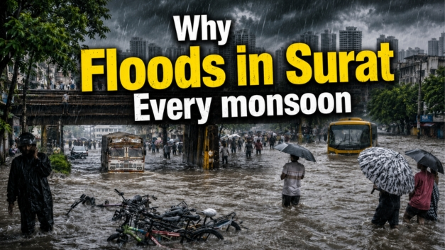
Surat Monsoon Problems like Waterlogging exist in 2026 also. Every year, as the Southwest Monsoon hits the Diamond City, a familiar and frustrating headline takes over the news: “Surat Paralyzed by Severe Waterlogging.” Heavy downpours trigger intense flooding across major commercial hubs, industrial zones, and residential areas.
Despite the Surat Municipal Corporation (SMC) launching extensive pre-monsoon action plans year after year, key junctions like the Surat-Navsari Road, Udhna, Varachha, and Limbayat regularly turn into rivers. Why does a globally recognized “Smart City” face the exact same urban flooding crisis every single monsoon?
The answers lie in a complex mix of unique geography, natural drainage limitations, and rapid infrastructure expansion.
The Core Causes Behind Surat’s Annual Waterlogging
1. The Critical “Flood Gate” Dilemma (Tapi River Levels)
Surat’s geography is inherently tied to the River Tapi, which runs right through the city before emptying into the Arabian Sea just 16 kilometers west. When intense rainfall hits the region, the Tapi flows at high flood levels, and the downstream water level rises.
To prevent the swollen river from back-flowing into the city’s internal sewer networks, the SMC is forced to close major municipal flood gates (such as those at Hanuman Tekri, Bharimata, and Amroli).
The Bottleneck: Once these flood gates close, the city’s internal storm water drainage lines lose their natural gravity-based outlet to the river. Even with massive high-capacity dewatering pumps working around the clock, heavy rainfall cannot escape fast enough, backing up directly onto the city streets.
2. High Tide Coincidence & Low-Lying Topography
Surat has an average elevation of just 13 meters above mean sea level. Coastal belts and newly expanding fringes like Hazira, Dumas, Vesu, and Bhimpor are exceptionally low-lying.
If heavy downpours happen to align with a high tide in the Arabian Sea, the natural drainage system is pushed to a complete standstill. The sea pushes water inland, the river swells, and the city’s low-elevation drainage channels choke up almost instantly.
3. Siltation of Natural Creeks (Khadis)
Surat relies on a natural web of creeks—including the Mithi Khadi, Kakara Khadi, Bhedwad Khadi, and Bhatena Khadi– to empty excess storm water southward into the Mindhola River. Over the decades, these critical natural escape routes have severely degraded due to:
- Heavy silt accumulation that makes the creek beds shallow.
- Wild growth of weeds and unauthorized waste dumping.
- Structural encroachments along the banks that narrow down the water’s path.
When any of these Khadis cross their danger levels (e.g., Mithi Khadi’s 9.35-meter limit), surrounding neighborhoods like Limbayat experience prolonged waterlogging that takes days to recede.
Data Analysis: Highly Vulnerable Areas & Triggers
Data compiled from historic SMC monsoon logs and drainage studies highlights how localized rainfall rapidly triggers flooding across different city zones:
| Affected City Zone | Key Localities Highly Vulnerable | Primary Technical Cause | Typical Impact Level |
| Central Zone | Kadarshah Ni Nal, Hodi Bungalow, Sagrampura | Below-grade elevation; immediate closure of river outlets/flood gates. | High traffic disruption; commercial closures. |
| Limbayat Zone | Mithikhadi, Bhatena, Maruti Nagar | Overflowing of the Mithi and Bhatena Khadis due to heavy siltation. | Severe residential flooding; water entering homes. |
| Udhna Zone | Udhna Railway Station area, GIDC patches | Network congestion; heavy runoff from industrial rigid concrete pavements. | Industrial logistical delays; stranded commuters. |
| Varachha & Katargam | Varachha Main Road, Podar Avenue | Rapid urbanization outpacing older storm water pipe capacities. | Knee-deep water logging; slow transit movement. |
How Urban Development Aggravates the Problem
The transformation of Surat into an economic powerhouse has inadvertently escalated its urban flooding risks.
As soft soil and open green pockets are replaced by rigid concrete roads and high-density buildings, the ground loses its ability to naturally absorb rainwater. Instead of soaking into the Earth, 100% of the precipitation instantly converts into surface runoff, completely overwhelming the existing storm water networks within just 30 to 45 minutes of a cloudburst.
Moving Forward: What Surat Needs
To transition out of this annual cycle, experts point toward a shift from temporary pre-monsoon desilting to long-term climate-resilient infrastructure. This includes widening and concrete-lining the structural banks of internal creeks (khadis), constructing subterranean holding ponds to trap initial surges, and scaling up automated, smart-monitored pumping stations at low-lying river outlets.
Until these systematic macro-upgrades match the scale of the city’s rapid expansion, the diamond capital will continue to test its civic resilience with every major monsoon spell.
Must read, Surat Weather Forecast (July 4 to July 19, 2026)
Watch Latest News Videos on KRH News: Click Here