


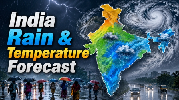
India Weather Forecast: As the Southwest Monsoon aggressively advances across the subcontinent, the India Meteorological Department (IMD) has issued a comprehensive weekly weather summary and forecast from July 1st to July 8th, 2026.
Crucial systems including a highly active seasonal trough spanning from Punjab to Bihar and a strengthening low-level Somali Jet over the Arabian Sea, are set to trigger heavy to very heavy rainfall in multiple states, accompanied by a welcome drop in temperatures.
Key Highlights & Active Weather Systems
- Monsoon Advance: As of late June, the Southwest Monsoon has successfully covered remaining parts of Bihar, Jharkhand, and Chhattisgarh, while pushing deeper into Madhya Pradesh, Uttar Pradesh, Uttarakhand, and Himachal Pradesh.
- Temperature Drop: A significant relief from summer heat is expected across the plains of Northwest India and Maharashtra, with maximum day temperatures projected to fall by 3 to 5°C during the first half of the week.
- Wind and Thunderstorm Alerts: Severe thundersqualls with gusty winds reaching 50 to 70 kmph are anticipated in regions like East Rajasthan, alongside widespread lightning alerts across Central and East India.
State-Wise Rainfall & Temperature Forecast Matrix of India Weather Forecast
The following table details what to expect across major regions between July 1st and July 8th, 2026:
| Region / States | Rainfall Intensity & Distribution | Temperature Impact & Outlook | Significant IMD Alerts |
| Northwest India (HP, Uttarakhand, J&K, Punjab, Haryana, Delhi, UP) | Fairly Widespread to Widespread rain over hilly states. Isolated heavy spells over Punjab, Delhi, and UP between July 1st and July 4th. | Maximum temperatures will drop sharply by 4–5°C by July 4th. | Isolated thunderstorm activity and lightning during the first half of the week. |
| West India (Gujarat Region, Konkan & Goa, Saurashtra & Kutch, Madhya Maharashtra) | Widespread rain in Konkan & Goa all week. Heavy downpours scaling up in Gujarat and Central Maharashtra from July 3rd to July 6th. | Temperatures in Gujarat remain stable initially, dropping by 3–4°C after July 1st. | Risk of localized waterlogging and flash floods in low-lying coastal urban zones. |
| Central India (East & West Madhya Pradesh, Chhattisgarh, Vidarbha) | Fairly Widespread to Widespread rain across the entire zone. Isolated very heavy rainfall expected between July 2nd and July 4th. | Day temperatures expected to drop by 2–4°C after July 2nd. | High alert for lightning and gusty surface winds (40–50 kmph). |
| Northeast & East India (Assam, Meghalaya, Arunachal, West Bengal, Sikkim, Bihar, Odisha) | Widespread rain over Assam, Meghalaya, and Sub-Himalayan West Bengal. Heavy to very heavy isolated spells throughout the week. | Mostly near-normal minimum and maximum temperatures across the board. | Extremely heavy rain warning for isolated pockets of Sikkim and Meghalaya. |
| South Peninsular India (Kerala, Coastal & Interior Karnataka, Telangana, Tamil Nadu) | Widespread rain over Coastal Karnataka, Kerala, and Lakshadweep. Fairly widespread activity in Telangana and Andhra Pradesh starting July 4th. | Stable monsoon temperatures with cool, humid sea breezes. | Squally weather along the western coast; fishermen are advised to monitor maritime updates. |
Regional Breakdown: What to Expect Locally
Northwest Plains & Western Himalayas
Hilly terrains like Uttarakhand and Himachal Pradesh are on high alert for landslide vulnerabilities due to sustained wet spells. For the NCR plains (including Delhi, Chandigarh, and Haryana), steady pre-monsoon and monsoon showers will keep weather conditions comfortable, mitigating any lingering heatwave tendencies.
The Western Coast and Gujarat
An active trough stretching down the west coast ensures that Konkan, Goa, and coastal sectors remain highly saturated. Residents in urban hotspots across Central Maharashtra and South Gujarat should brace for intense spells starting July 3rd, which could temporarily impact local transit and drainage infrastructure.
Central Heartlands
Madhya Pradesh and Chhattisgarh are entering their peak early-monsoon saturation phase. The IMD notes that strong easterly and southeasterly wind anomalies from the Bay of Bengal are channeling massive moisture directly into these central plains, making heavy evening thunderstorms highly probable.
Must read, Gujarat Weather Forecast (June 24 to July 8): Mega Monsoon Regional & District-Wise Rain Analysis
Watch Latest News Videos on KRH News: Click Here