


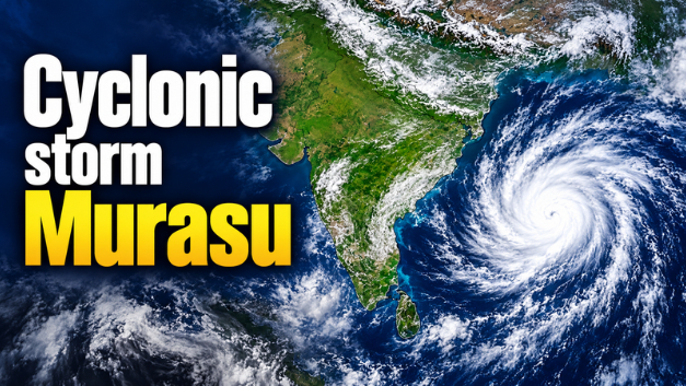
Cyclone Murasu has intensified into a severe cyclonic storm over the west-central Bay of Bengal, prompting weather alerts across parts of southern India. The India Meteorological Department (IMD) has forecast that the storm will cross the south Andhra Pradesh coast between late Monday night, November 2, and the early hours of Tuesday, November 3, 2026.
With strong winds, heavy rainfall and possible coastal flooding expected in vulnerable areas, authorities are preparing for the approaching storm.
Here are the latest updates, expected landfall time, wind speed, affected states and weather warnings.
Cyclone Murasu Latest Update: Where Is the Storm Now?
According to the IMD’s November 2 bulletin, at 8:30 AM IST, Severe Cyclonic Storm Murasu was located over the west-central Bay of Bengal near latitude 14.1°N and longitude 81.4°E.
The storm was approximately:
- 160 km east-southeast of Nellore, Andhra Pradesh
- 180 km northeast of Chennai, Tamil Nadu
- 180 km east-southeast of Kavali, Andhra Pradesh
- 210 km southeast of Ongole, Andhra Pradesh
- 240 km south of Machilipatnam, Andhra Pradesh
Murasu moved west-northwestwards at around 22 kmph during the preceding six hours and is expected to continue towards the south Andhra Pradesh coast.
Cyclone Murasu Landfall: Date, Time and Expected Wind Speed
The IMD has forecast that Cyclone Murasu will cross the south Andhra Pradesh coast between Nellore and Narsapur, close to Ongole.
| Detail | Latest forecast |
|---|---|
| Expected landfall | November 2–3, 2026 |
| Landfall window | 11:30 PM on November 2 to 4:00 AM on November 3 |
| Expected landfall region | Between Nellore and Narsapur, near Ongole |
| Storm category | Severe Cyclonic Storm |
| Wind speed | 100–110 kmph |
| Maximum gusts | Up to 120 kmph |
These are forecast timings and wind speeds, not confirmed landfall observations. The storm’s actual movement and intensity may change.
Which States May Be Affected by Cyclone Murasu?
The storm is expected to influence weather conditions across several states, particularly along the eastern coastline.
1. Andhra Pradesh
South Andhra Pradesh is expected to face the direct impact of the cyclone. Strong winds, heavy rainfall and rough sea conditions are forecast around the landfall region. Coastal districts and low-lying areas are among the locations requiring particular attention. Residents should follow evacuation instructions and local administration advisories.
2. Tamil Nadu
Northern Tamil Nadu, including Chennai and surrounding areas, may experience rainfall and strong winds associated with the storm. Schools in Chennai and Tiruvallur were reported closed on November 2 as a precautionary measure. Coastal authorities have also advised people to avoid unnecessary visits to beaches during adverse weather.
3. Odisha
Southern Odisha is also expected to receive heavy rainfall under the influence of Murasu. The IMD has warned of heavy to very heavy rainfall in parts of the state, while disaster-response teams have been kept prepared in vulnerable areas.
4. Telangana
Parts of Telangana may experience rainfall and thunderstorms as the weather system influences surrounding regions. Residents should monitor the latest IMD district-level forecasts.
IMD Weather and Rainfall Warnings
The approaching cyclone has raised concerns about heavy rainfall, strong winds and rough sea conditions. The IMD has issued warnings for the affected coastal areas, with the highest concern around the expected landfall region.
Fishermen have been advised not to venture into the affected sea areas. People living in vulnerable coastal locations should follow official instructions, particularly if evacuation is ordered.
Schools, Flights and Transport: Latest Impact
Cyclone-related weather conditions have started affecting normal activities in some areas.
- Schools: Schools in Chennai and Tiruvallur were reported closed on November 2 as a precaution.
- Flights: Adverse weather has caused disruptions to air travel, including reported cancellations affecting Chennai and Vijayawada.
- Coastal activities: Residents and tourists have been advised to avoid exposed beaches and vulnerable coastal areas.
- Fishing: Fishermen have been advised to stay away from the sea in the affected areas.
Flight schedules and local transport arrangements may change depending on weather conditions. Passengers should check directly with airlines and transport operators before travelling.
Safety Guidelines for People in Cyclone-Affected Areas
Residents in vulnerable locations should take precautions before the storm reaches the coast.
- Follow official IMD weather bulletins and district administration instructions.
- Keep emergency medicines, drinking water, food and essential documents ready.
- Charge mobile phones and power banks in advance.
- Stay away from beaches, rivers, damaged structures and exposed coastal areas.
- Avoid travelling during periods of strong winds and heavy rainfall.
- Do not go outdoors to watch the cyclone or take photographs.
- Move to designated shelters if instructed by local authorities.
Will Cyclone Murasu Affect Gujarat or Surat?
As per the November 2 IMD bulletin, Cyclone Murasu is moving towards the south Andhra Pradesh coast over the Bay of Bengal. The forecast landfall region is far from Gujarat.
The current bulletin does not identify Surat or Gujarat as part of the direct landfall warning area. However, residents should continue checking official weather updates for any changes in wider weather conditions.
What Happens After Landfall?
After crossing the coast, the storm’s intensity and movement will determine rainfall and wind conditions across inland areas.
Authorities will continue monitoring the system, while disaster-response teams are expected to remain prepared in vulnerable locations. Residents should rely on updated IMD bulletins rather than assuming that conditions will immediately improve after landfall.
Conclusion
Severe Cyclonic Storm Murasu is approaching the south Andhra Pradesh coastline, with landfall forecast between late November 2 and the early hours of November 3.
With winds potentially reaching 110 kmph and gusts up to 120 kmph, the coming hours are important for coastal communities. Residents in affected areas should follow official warnings, avoid unnecessary travel and take safety precautions.
Update note: This report reflects information available from IMD bulletins and media reports on November 2, 2026. Cyclone forecasts can change, so readers should check the latest official advisories before making travel or safety decisions.
.Also read, 11-year-old Riaan Ghodawat Becomes First Indian to Attend Ballon d’Or 2026 Ceremony in London
Watch Latest News Videos on KRH News: Click Here